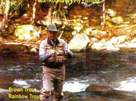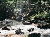
Kettle Creek is a large freestone tributary of the West Branch Susquehanna River in north central Pennsylvania and is considered to be one of the better trout streams in Pennsylvania. Kettle Creek has over 60 miles of class A water with approximately 20 of those miles of the lower section stocked by the Pennsylvania Fish and Boat Commission.
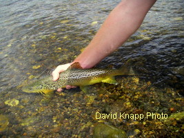
Billings Branch, Sliders Branch, Germania Branch, Cross Fork Creek, Hamersley Fork and Little Kettle are some of the major tributary streams that tend to keep its water cool. The upper section from Billings Branch tributary downstream to the 433 Bridge contains a healthy population of wild brown and brook trout, while the lower section contains mostly stocked trout although some wild trout survive here as well.
From Little Kettle Creek downstream past Ole Bull Park to the regulated water, the water is a mixture of fast riffles and runs with plenty of long slow runs. From its confluence with Cross Fork Creek which is also a good trout stream, Kettle Creek slows down with longer, slower moving runs and pools until it meets with the tributary of Hamersley Fork.
Hamersley Fork is also a good trout stream and it brings along more wild brown trout. From Hamersley Fork south to the Kettle Creek Reservoir the creek is a mixture of fast and slow water with larger pools and riffles.
Fishing Kettle Creek:
Kettle Creek has a delayed harvest fly fishing only section that starts 500 feet below SR 144 Bridge and extends upstream for 1.7 miles. Some wild trout and plenty of stocked trout including holdovers exist below the delayed harvest water down to Kettle Creek Lake.
Match the hatch and when possible use nymphs before a hatch for the best results. The upper portions of the stream have numerous hatches of mayflies and caddis flies as well as stoneflies. The water is mostly clear requiring short upstream presentations with drag free drifts. You will find the wild trout to be both Wiley and feisty requiring still more care.
Spring:
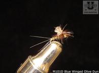
Expect to see the Little Black Early Stoneflies start to hatch in March and as soon as the water temperature reaches about 50 degrees, look for the hatches of the Blue Winged Olives, Blue Quills and Quill Gordons. The Hendricksons including the Red Quills will start to hatch in the first three weeks of May.
Summer:
In early summer look for the hatch of the March Browns and then watch for the Light Cahills and Pale Evening Duns to be hatching in the fast water sections. This activity will continue up to the second week of July.
Fall:
In early fall, there still will be opportunities for the terrestrial patterns and the Blue Winged Olives hatches will pick up again in late September and October.
Note: The “Perfect Fly” complete line of the most realistic flies are available in all the aquatic insect patterns that you will encounter on Kettle Creek.
Current information: The Kettle Creek Watershed Association is a local not-profit organization staffed by volunteers and supported by the Lock Haven, PA, Trout Unlimited. Their mission is to enhance, preserve, monitor and protect the Kettle Creek watershed. They are doing their first event with Project Healing Waters Fly Fishing this year. This will be a 3 day weekend on the first weekend in May for disabled/recovering military personnel with both physical and emotional needs. What is more peaceful that fly fishing? More info is on the website with a link to the National PHWFF site.
Reach the upper waters by taking Rt. 144 (Kettle Creek Road) East which follows Kettle Creek for some distance. Rt. 44 (Pine Hill Rd.) East crosses Kettle Creek and Rouch Rd off Kettle Creek Road may provide access where it crosses Kettle Creek but these approaches will necessitate some hiking.
Hatch Chart for Central Pennsylvania
View Northeast USA in a larger map


