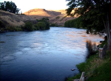
The two-hundred mile long Deschutes River (river of falls) is a tributary of the mighty Columbia River. The Deschutes River begins in the Cascades at Little Lava Lake and then flows into Crane Prairie Lake and Wickiup Lake and then over Pringle Falls before its confluence with the Little Deschutes River. Below these lakes, the river drops about 750 feet through canyons of lava creating plenty of fast water and some white water sections.
After this fast section the Deschutes slows down and flows through the City of Bend into a huge irrigation canal system which drains off a good deal of the flow in the summer months. As the Deschutes continues down toward the Billy Chinook Reservoir it passes through what is known as the Middle Section which is somewhat more difficult to access.
The Lower Deschutes River is completely different as it flows through a basalt canyon that runs through the high desert of Central Oregon. From the base of the Pelton Dam to its confluence with the Columbia River for about 100 miles, the Deschutes provides more native rainbow trout and steelhead fishing. The trout population is said to exceed 3500 fish per mile of water.
The Lower Section of the Deschutes is also broken into three major sections of water.The upper section of the Lower Deschutes River is between Warm Springs and Maupin. From Maupin to Mack's Canyon we have the middle section of the Lower Deschutes River; and from Mack’s Canyon to the Columbia River we have the lower section of the Lower Deschutes River.
Fly Fishing the Deschutes River:
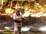
The Upper Deschutes has a good population of brown, brook and rainbow that are eager to take dry flies which makes it a delight to fish. Wading is easy, the wild life is abundant and the scenery is at its best. The Upper Deschutes River flows into Crane Prairie and Wickiup Reservoir and both are stocked with both brown and rainbow trout. The section between the two reservoirs has some good brown trout as well. Public access is easy because most of the river is in the Deschutes National Forest in the Cascades Mountains.
After Wickiup on the way to Bend, the river flows over Pringle Falls, Benham Falls, Dillon Falls and Lava Island Falls and through a canyon with steep walls. This area provides good fly fishing as well. Right in the town of Bend there are several riffles that contain the famous Redside Trout, a hybrid of rainbow trout and cutthroat trout. The chemistry of the stream provides for a healthy community of aquatic insects including mayflies, caddis flies and stoneflies.
The middle section can be problematic in the summer months as the temperature and the flow of the water suffers, However, dry fishing remains excellent. The river flows Juniper and Sage where there are numerous Ponderosa Pines. There are several access points even though there is a good bit of private property. The Middle Section of the Deschutes River ends at Lake Billy Chinook.
Some consider the Lower Section of the Deschutes the finest river in Oregon and a top one in the United States because it has huge returns of Summer Steelhead. In addition to the Steelhead, there is also a great population of Redside rainbow trout that average about 15 inches with some up to 20 or more inches.
The summer run of steelhead starts in August and runs through the end of December, but the prime steelhead fishing is in September and October. There are some stocked steelheads ranging about nine pounds. The wild steelhead are referred to as "A" run and "B" run. The "A" run wild steelhead enter into the Deschutes in July and August and they will average from four to six pounds. The "B" run steelhead enter the river from August to September and average about twelve pounds or more.
Usually it is better to fish for the steelhead early and late in the day as the steelhead prefer to avoid the bright sun. Use a floating line presented down and across the runs allowing the fly to swing across the runs to the down stream position.
From Warm Springs downstream to Mauplin, there is a good population of rainbow trout providing some excellent fly fishing. Wading the river is possible but there are some places where access is very limited. It is best to fish this section from a drift boat. It will take at least two days to float from Warm Springs down to Mauplin. The area immediately around Mauplin and down to Mack’s Canyon however has good access but the fishing pressure for steelhead is heavy. Below Mack’s Canyon there is about 25 miles where there is again little access.
Spring:
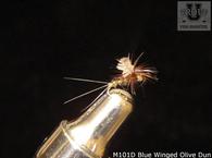
March Browns can hatch in decent quantities during March and April as will the Mahogany Duns. Blue-winged Olives start hatching in the lower section in February, and continue into May. The Pale Morning Dun hatches in May and June and it is the most important Mayfly. Also in May and June are the salmon flies and the golden stoneflies as well as the Green Drakes.
Summer:
Caddisflies are very plentiful in the Deschutes River. The Spotted Sedges, which consist of several different species, hatch from March through September. The little Short-horned Sedges hatch at about the same time. There are also several species of Green Sedges that hatch from the first of March all the way through October. Imitations of their larvae, called "rock worms", are effective flies anytime you fish the river. Yellow Sallies, or Little Yellow Stoneflies, hatch in June and July.
Fall:
The bi-brooded Blue winged Olives and the bi-brooded Mahogany Duns will be hatching again in September and October. The larger October Caddis start hatching about the middle of September and last until about the middle of November. Midges will be effective in the fall as well as all year around as will the streamers. Streamers of Sculpin, Minnows, Baitfish and Crayfish can be used.
Winter:
Fishing remains good all year long on the Deschutes River with the Steelhead being a possibility through December.
Access is generally good, however there are several areas where float fishing will work best. Public access is easy in the Upper Deschutes because most of the river is in the Deschutes National Forest in the Cascades Mountains. The Middle Section is more difficult to access.
View Deschutes River in a larger map


