The Cataloochee Creek lies in the Cataloochee Valley surrounded by some of the most rugged mountains found in the southeastern United States and is one of the most remote regions of the Great Smoky Mountains National Park. It is often referred to as the “Forgotten Far East” because it is so remote and it is so far to the east within the GSMNP.
Today, the valley offers a wide variety of animals including the
Elk herd introduced into the park in 2001. The herd can frequently be seen in grazing peacefully in the fields of the valley, especially just before the sun sets. Other
wildlife that can be spotted include bear, deer, and turkeys. To enjoy this magnificent valley, a primitive campground with 27 campsites. The camp sites have no hook ups but flush toilets and a wash sink is available. Revervations are required for the sites which remains open mid-March through October.
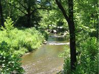
The Cataloochee Creek is formed by PalmerCreek, Little Cataloochee Creek, and Caldwell Fork, all streams that converge to form the river. The Cataloochee Creek flows approximately seven miles through open fields and glades within the GSMNP before leaving to empty into
Walters Lake an impoundment on the
Pigeon River.
Fishing the Cataloochee Creek:
The creek flows trough a gradual change in elevation, creating long runs and riffles as opposed to the pocket waters found in the steeper streams within the GSMNP. These long runs provide ample opportunity to show off your long delicate casts and let the flies drift slowly down the stream. A good floating fly is advised for these conditions. At this point, the creek resembles a river being wide and slow moving.
Rainbow trout inhabit the upper reaches of the creek while the big browns inhabit the lower reaches of the creek. Be prepared to hike to the last couple of miles of the creek in search on the big browns. Be sure to have some terrestrials along especially hoppers in the early months of summer when the fields are mowed.
Spring:
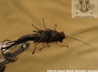
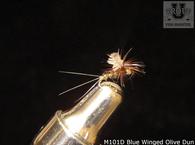
This is by far the best time to fish the "Cat" as the water is running good and it remains clear for the most part. You will want to have several nymphs as well as dry flies along. I suggest some dry flies as well and be prepared for the mayflies and th stoneflies to hatch.
Summer:
This is a beautiful time to fish the Cataloochee as the water is low enough for comfortable wading in shorts or with hippies. It is especially good time for terrestrials such as hoppers and ants.
Fall:
Fall is a short season since the road may become difficult to travel and unpredictavle in the later months. the fishing remains good in September and October and the scenery is magnificant. Be prepared for the terrestrials and streamers such as the Muddler Minnow.
Winter:
Winter fishing is not recommended due to the difficulty in reaching the valley. and the uncertainity of the road closing.


