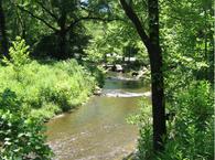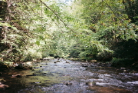
Whitetop Laurel Creek is often called Virginia’s finest trout stream. The headwaters are in the Konnarock portion of the Mt. Rogers National Recreational Area located in southwest Virginia and it flows down to Damascus, Virginia where it meets the Tennessee Laurel.
There are two wild trout regulated sections, single hook artificial only: The top one runs from the first trestle above upper gate in Taylors Valley to the Green Cove Creek Junction. The bottom wild trout area runs from just below the lower gate at Taylors Valley down to the confluence with the Straight Branch. The Whitetop Laurel is hatchery supported both above and below these portions as well as the portion directly in Taylors Valley. The stocking schedule for Washington county including the Whitetop Laurel can be found at the Virginia Department of Game and Inland Fisheries.
Fishing the Whitetop Laurel:
 The Whitetop Laural Creek can be easily fished all year long. The mayfly hatches, including the Blue winged Olives, occurs for a long period of time and will provide some of the best fishing. The spinner fishing with these mayfly imitations is especially effective in the late afternoon. Fish the Whitetop Laurel in an upstream direction using the up and across casts avoiding the unnatural drifts. Nymphs will always be effective and an attractant dry fly in tandem will improve your odds.
See our Whitetop Laurel Creek hatch chart before you go.
Spring:
The best time to fish the stream would be during the months of March, April and May when there are a lot of hatches
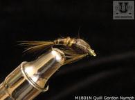
occurring. Start with the Quill Gordons, the Little Yellow Stonefly, the Light Cahill, and the March Browns in April.
Summer:
Fishing the wild waters in the higher elevations will be most rewarding. Use the Blue Winged Olive, Giant Black Stonefly, and the terrestrial patterns later in the summer. In the late afternoons, especially during cloudy weather and in the faster moving waters, try the spinners in the seams and the pocket waters.
Fall and winter:
Fall is both an excellent time and a beautiful time to fish the Whitetop Laurel Creek. The colorful leaves along the Virginia Creeper are worth the trip, but the fishing is great as well. Start with the Blue Quills, and the Little Black Caddis flies as well as the Midges in hook size of 18,.
By the way a good place to stay is the Apple Tree Bed and Breakfast operated by Debbie and Les Smith in Damascus and while you are in the area, stop by the Barter Theater in Abingdon, VA.
The easiest access to the Whitetop Laurel Creek is by taking highway 58 east from Damascus, VA. Highway 58 follows Whitetop Laurel for about 4 miles up to the confluence with Straight Branch where there is parking, rest rooms and picnic areas. Highway 58 continues up to a gravel road leading to Creek Junction where there is access for fishing as well.
Of course the Whitetop Laurel Creek can be accessed fropm the Virginia Creeper bike trail. There are outfitters like the Virginia Creeper Bike Shop who will rent out bikes and provide shuttle service to the trailhead for a very reasonable fee.
erhaps a better access is Taylors Valley which is sort of a midpoint in the stream. To get to Taylors Valley go east from Damascus on 58, turn right on 91, then a left turn onto SR 725 and follow that to the junction of SR 726, There is parking available as well as the Creeper Trail Cafe, where you can get a quick meal. From there you can hike up and down the stream as there are no trails in this area.
View Southeast USA in a larger map


